Highways
 Figure 21: St. Louis, 1910. Source: SkyscraperPage.com [25]
The history of highway planning in St. Louis falls under the jurisdiction of the Missouri Department of Transportation. In the early 1900s and prior, road projects and improvements were under the authority of the counties. As the number of automobiles on the roads increased, a growing need to replace road deficiencies arose, so legislation was passed to address this issue. In 1909, a fund for all road purposes and functions was created under the “General State Road Fund” and in 1913 a law was passed creating the State Highway Department to replace its previous location under the Department of Agriculture. [26] Additionally, a highway commissioner would be appointed to head the department. Another piece of legislation, the Hawes Law, approved 122 projects directed at road improvements and by the end of 1917, over 11,000 miles of roads had been developed.
The origins of the modern highway and transportation commission were derived from the Centennial Road Law of 1921. This law was very influential because it shifted the authority of road building from local to state authority. It “empowered the commission to locate, design, construct and maintain a ‘state highway system’" and called for 6,000 miles of secondary roads and 1,500 miles of primary roads. This law further laid the foundation for the highway system of today by giving the State Highway Commission the power to supervise all projects involving highways and roads as well as form a team of a “commission secretary, chief engineer, and chief counsel” that is approved by the commissioner’s appointment. [26] The aggressive plan for rebuilding and renovating the roads during the 1920s and 1930s was commonly referred to as “Getting Missouri out of the Mud.” [26] However, the two world wars and the Great Depression reduced available resources and stalled these efforts partially.
The origins of the modern highway and transportation commission were derived from the Centennial Road Law of 1921. This law was very influential because it shifted the authority of road building from local to state authority. It “empowered the commission to locate, design, construct and maintain a ‘state highway system’" and called for 6,000 miles of secondary roads and 1,500 miles of primary roads. This law further laid the foundation for the highway system of today by giving the State Highway Commission the power to supervise all projects involving highways and roads as well as form a team of a “commission secretary, chief engineer, and chief counsel” that is approved by the commissioner’s appointment. [26] The aggressive plan for rebuilding and renovating the roads during the 1920s and 1930s was commonly referred to as “Getting Missouri out of the Mud.” [26] However, the two world wars and the Great Depression reduced available resources and stalled these efforts partially.
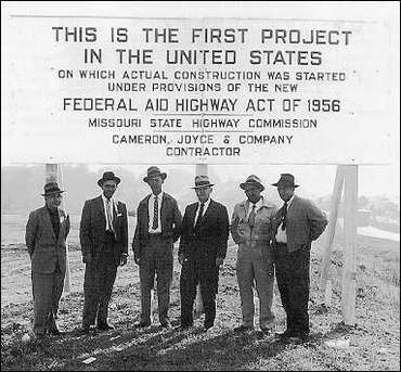 Figure 22: 1956 Federal Aid Highway Act. Source: F.H.W.A [27]
Following WWII, the coffers of the commission were replenished and they were able to enact a plan in 1952 that would expand and revive road systems, called the “Takeover Program.” The primary focus was to upgrade over 12,000 miles of roads to enhance the “farm-to-market” highway system and provide rural Missouri with nearby state-maintained roads. At the end of this 10 year program, over 95% of citizens in rural Missouri had an updated road within two miles of their residence. The increased accessibility of roads and highways prompted the development of the interstate system. In 1956, Missouri became the first state to embark on the new highway program passed by Congress. Over $5 million was spent together on construction along Route 66 and Route 40, which passes through St. Louis. These projects continued through 1979, when the Missouri Highways Department merged with the Department of Transportation to form the Missouri Highways and Transportation Department. [26]
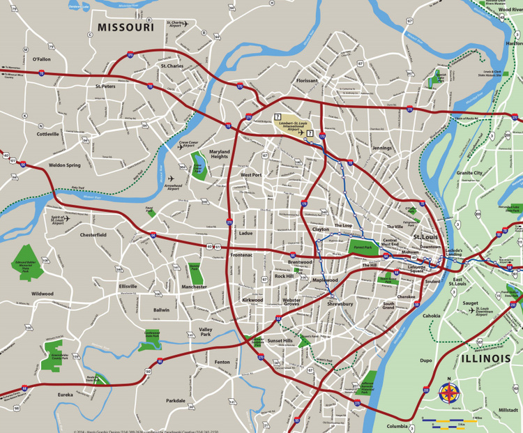 Figure 23: Various interstates connect with the St. Louis area. Source: Explore St. Louis [29]
The highway sprawl seen in St. Louis and Missouri was indicative of the boom in the automobile occurring across the country. From the 1970s-1990s, the number of trips by car increased 50 percent, the amount of driven miles went up by over 80 percent, and the number of vehicles rose by 128 percent. [28] This trend explains why land use has been primarily dedicated to highways, roadways, and parking lots to match this increased use of automobiles. Today, St. Louis is a crossroads of about 6 major interstate freeways, notably the I-70 and I-55, which stretch over a large portion of the country (see Figure 23). This makes car transportation relatively easy to anywhere in St. Louis due to a wide variety of possible routes. Downtown St. Louis offers over 130 parking areas that include a mix of surface lots and high-rise structures to account for the large automobile demand (see parking map below in Figure 24).
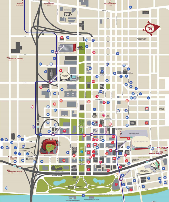
Figure 24: Parking Areas Available Downtown. Source: Explore St. Louis [30]
References:
[25] SkyscraperPage.com. Accessed September 1, 2014. http://s148.photobucket.com/user/warwickland/media/aerial1.jpg.html.
[26] "Missouri Highways and Transportation Commission - General Information Commission Background." Missouri Department of Transportation. Last modified 2014. Accessed August 18, 2014. http://www.modot.org/about/commission/CommissionGeneralInfo.htm.
[27] "Public Roads." Federal Highway Administration. Accessed August 31, 2014. http://www.fhwa.dot.gov/publications/publicroads/96summer/p96su18.cfm.
[28] Kemp, Roger L., ed. Cities and Growth: A Policy Handbook. Jefferson, NC: McFarland & Company, 2008.
[29] “Maps." Explore St. Louis. Accessed August 18, 2014. http://explorestlouis.com/wp-content/uploads/2014/01/St.-Louis-Metro-Area-1-22-14.pdf.
[30]"Maps." Explore St. Louis. Accessed August 18, 2014. http://explorestlouis.com/wp-content/uploads/2014/04/Dowtown-St.-Louis-Parking-Guide.pdf.
